Atlanta BeltLine Overlay Zoning
Parcels in the area of study as well as the BeltLine Overlay.
|
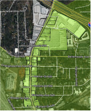
What is the Beltline Overlay?The Atlanta BeltLine Overlay establishes urban design regulations to anticipate, guide, and manage quality development opportunities within the BeltLine planning area. To the right is a map of which parcels are within the BeltLine Overlay; the parcels within the Howell Mill Road Redevelopment Blueprints are in white while the overlay is represented in green.
How does it impact my property?The overlay does not result in any immediate changes to your property! What it does affect are future uses and future redevelopment by placing certain standards and restrictions to ensure livability through zoning.
|
How will it impact future development?
Currently, the section of Howell Mill Road which is under consideration in this study caters to the automobile with drive-through restaurants and an abundance of parking lots.
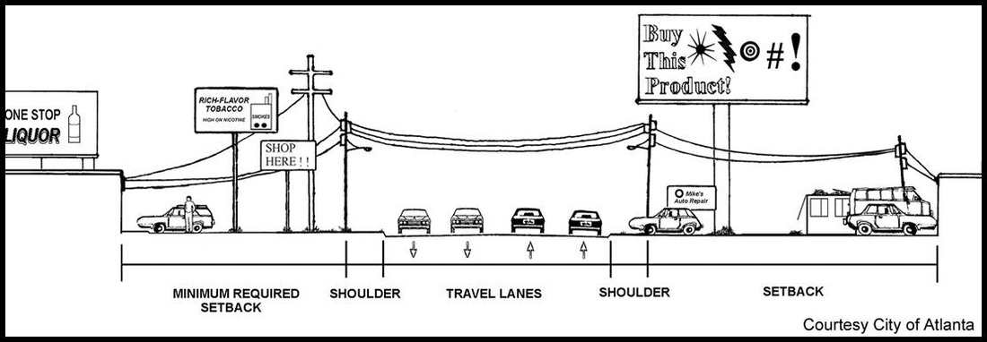
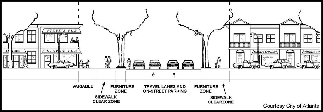
The BeltLine Overlay will, over time, redevelop the landscape into a more livable, pedestrian and cyclist friendly, environment.
What are some BeltLine Overlay principles?
- Off-street parking requirements (auto and bicycle)
- Site limitations
- Transitional uses and yards
- Driveway configuration
- Loading and associated areas
- Security and maintenance requirements
- Fronting buildings to the street
- Landscaping and lighting requirements
- Wide sidewalks
